
Using technology to return green cover to Tanzanian city
Students and data scientists use artificial intelligence to map green cover to allow authorities to plant trees in proper places
By Kizito Makoye
DAR ES SALAAM, Tanzania (AA) – To increase green space in the Tanzanian port city of Dar es Salaam, university students are using cutting-edge technologies to map trees with a high level of accuracy.
Trained by Tanzania’s Resilience Academy – an initiative of the Tanzania Urban Resilience Program (TURP) – students and data scientists have developed a novel tool using a computer algorithm to quantify tree cover in the city.
Speaking to Anadolu Agency, Rebeka Mponeja, a data scientist, said her team was developing data to aid city planners to know about the existing vegetation. She said the tools not only map the existing tree canopy but also record air quality, tree loss from disease, and the nature of the neighborhood.
“When new trees are planted in such areas, we hope that the vegetation will flourish, clean and cool air and improve the health of the people most in need,” she said.
She said the tools backed by artificial intelligence have helped them to identify real and perceived tree cover in city landscapes with a high level of accuracy.
Lilian Lymo, 23, is among dozens of university students who have been recruited to map the city’s tree canopies using artificial intelligence.
“Trees have a lot of benefits such as reducing air pollution and absorbing water that can cause destructive floods,” she said.
She said that in the densely populated Tandale slum, which has less natural vegetation and tree canopies residents have repeatedly suffered from extreme heat as there is a green cover to provide shade or absorb run-off from sudden rainfall.
According to her, the use of technology and detailed satellite imaging has made it easy to identify areas with less tree canopy cover and alert policymakers to make appropriate decisions.
- Low tech strategy with low results
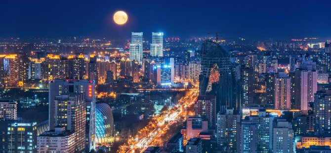
As one of the fastest-growing cities in Africa, Dar es Salaam is a major driver of climate change, responsible for the emission of hazardous gases into the atmosphere which increases air pollution and causes heat stress extremes, environmental experts said.
Experts say, while policymakers routinely encourage tree planting, the low-tech strategy has not yielded the results.
Applauding the move, Joseph Kuzilwa, professor of urban economics at the Mzumbe University, said the move to map trees will help to restore the lost urban tree canopies which have led to increasing temperatures to dangerous levels.
“Policymakers need to prioritize urban tree canopies in their projects to increase the livability of the city and reduce the urban heat island effect. City planners too should identify the best tree species to be planted in the city center” he said.
Through this initiative, young people are using their strong digital skills to quickly identify barren areas in the city’s neighborhoods.
Omari Kumbilamoto, the mayor of Dar es Salaam city, said the project has allowed city authorities to initiate tree-planting campaigns properly.
“I am very impressed by these young people. They have been able to collect useful data on city trees, which we use for development purposes,” he said.
Kaynak:![]()
This news has been read 146 times in total




Türkçe karakter kullanılmayan ve büyük harflerle yazılmış yorumlar onaylanmamaktadır.